Utility networks are the backbone of modern infrastructure, supporting essential services such as electricity, water, gas, telecommunications, and wastewater management. As these networks continue to expand in size and complexity, utility providers face mounting challenges in maintaining reliability, improving operational efficiency, and planning for future growth.
Traditional utility management methods often rely on disconnected systems, manual inspections, and reactive maintenance practices. While these approaches have served the industry for years, they are no longer sufficient for managing today’s data-rich, interconnected utility environments.
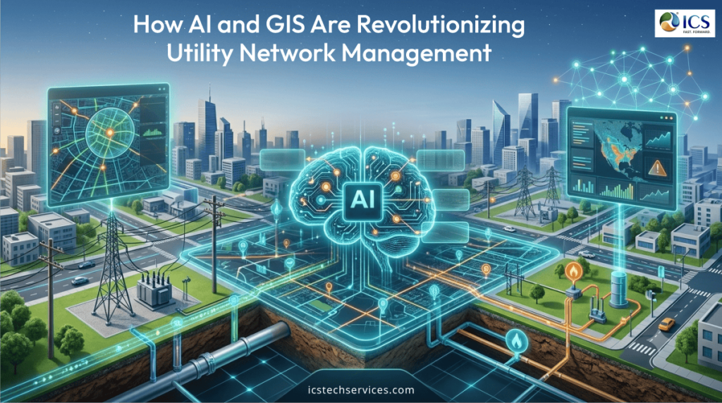
The convergence of Artificial Intelligence (AI) and Geographic Information Systems (GIS) is changing this landscape. Together, these technologies are enabling utilities to make faster decisions, optimize network performance, improve asset visibility, and build more resilient infrastructure.
Why Utility Network Management Is Becoming More Complex
Utility providers today manage thousands of geographically dispersed assets, including pipelines, transmission lines, substations, transformers, valves, underground utilities, and communication infrastructure. Each asset generates valuable operational data but turning that information into actionable insights remains a significant challenge.
Utilities must also contend with:
- Aging infrastructure requiring modernization
- Increasing demand for uninterrupted services
- Rapid urbanization and network expansion
- Climate-related disruptions and extreme weather
- Rising regulatory and sustainability expectations
Managing these challenges requires more than accurate maps. It demands intelligent systems capable of connecting location data with operational intelligence.
GIS: The Digital Foundation of Modern Utilities
Geographic Information Systems (GIS) have become indispensable for utility organizations. Rather than simply displaying infrastructure on a map, modern GIS platforms create a comprehensive digital representation of utility assets and their relationships.
GIS enables utilities to:
- Maintain accurate asset inventories
- Visualize underground and above-ground infrastructure
- Monitor network connectivity
- Support field operations with real-time location data
- Improve planning for maintenance and expansion
By centralizing spatial information, GIS creates a single, reliable source of truth for engineering, operations, and maintenance teams.
AI Is Taking GIS Beyond Mapping
While GIS provides location intelligence, AI transforms that information into actionable decision support.
AI algorithms analyze large volumes of spatial and operational data to identify patterns, predict failures, and recommend optimal actions. This enables utilities to shift from reactive operations to proactive network management.
Some of the most valuable applications include:
- Automated analysis of utility network performance
- Identification of high-risk assets
- Forecasting infrastructure degradation
- Optimized maintenance scheduling
- Intelligent infrastructure planning
Rather than simply showing where assets are located, AI helps explain how they are performing and what actions should be taken next.
Smarter Asset Management Through AI and GIS
Asset management is one of the most important responsibilities for utility organizations. Maintaining infrastructure based solely on age or fixed schedules often results in unnecessary maintenance or unexpected failures.
By combining GIS with AI-powered analytics, utilities gain a much clearer understanding of asset health.
This allows organizations to:
- Prioritize maintenance based on actual condition
- Predict equipment failures before they occur
- Allocate maintenance resources more effectively
- Extend the operational life of critical infrastructure
The result is improved reliability and reduced maintenance costs.
Improving Outage Response and Network Resilience
When outages occur, speed is critical. AI-enabled GIS platforms help utilities respond faster by providing real-time visibility into affected assets and surrounding infrastructure.
Integrated systems can:
- Identify likely fault locations
- Analyze outage impacts
- Recommend restoration priorities
- Dispatch field crews using optimized routing
This reduces restoration times while improving customer service and operational efficiency.
As climate events become more frequent, these capabilities are becoming increasingly valuable for building resilient utility networks.
Supporting Infrastructure Planning and Expansion
Planning future utility infrastructure requires accurate information about existing networks, land use, environmental conditions, and population growth.
AI-enhanced GIS supports infrastructure planning by:
- Evaluating multiple routing scenarios
- Identifying potential conflicts before construction
- Optimizing network expansion strategies
- Supporting environmental and regulatory assessments
These insights reduce project risks while helping utilities invest more effectively in future infrastructure.
Enabling Data-Driven Decision Making
Utilities generate enormous amounts of information from field inspections, IoT devices, SCADA systems, drones, customer systems, and operational platforms. Without integration, much of this data remains isolated.
AI and GIS bring these information sources together into a unified decision-making environment.
Benefits include:
- Improved operational visibility
- Faster engineering decisions
- Better resource allocation
- More accurate performance reporting
- Enhanced collaboration between engineering and field teams
This integrated approach enables utilities to make decisions based on real-time intelligence rather than assumptions.
Preparing Utilities for the Future
Emerging technologies such as digital twins, smart grids, connected sensors, and autonomous inspections will continue to reshape utility operations. AI and GIS will serve as the foundation for these innovations by providing the intelligence needed to manage increasingly complex infrastructure.
Organizations that invest in intelligent geospatial solutions today will be better positioned to improve operational efficiency, strengthen resilience, and support sustainable infrastructure development for years to come.
How ICS Helps Utilities Build Smarter Networks
At ICS, we help utilities unlock the full potential of AI and GIS through comprehensive spatial solutions, utility mapping, and digital engineering services. Our expertise enables organizations to transform complex infrastructure data into actionable intelligence that supports better planning, operations, and asset management.
Our utility-focused capabilities include:
- GIS-based utility mapping and asset management
- Geospatial data capture and analysis
- Spatial intelligence for infrastructure planning
- Utility network mapping and digital documentation
- Smart grid and digital utility support
- Engineering solutions that improve visibility, coordination, and long-term network performance
By combining engineering expertise with advanced geospatial technologies, ICS helps utilities modernize their operations while preparing for the future of connected infrastructure.
Transform Utility Network Management with ICS
Modern utility management requires a lot more than accurate maps. It requires intelligent, connected systems that deliver meaningful insights. AI and GIS are empowering utilities to improve decision-making, optimize network performance, and build resilient infrastructure capable of meeting tomorrow’s demands.
Partner with ICS to leverage AI-powered GIS, utility mapping, and geospatial solutions that enable smarter planning, efficient operations, and stronger utility networks.